The Barnegat Bay watershed – the land area draining to the bay – encompasses over 600 square miles. The watershed can be further divided into subwatersheds associated with the major waterways flowing to the bay (Metedeconk River, Toms River, Cedar Creek/Forked River/Oyster Creek complex, and Mill Creek and the southern streams).
Each of these subwatersheds has a unique mix of land-use types, ranging from undeveloped (forests, marshes, grasslands, and wetlands) to lightly developed (agricultural lands and rural communities) to more highly developed (suburban and urban neighborhoods and commercial/industrial areas). These different land-use types influence the quality and quantity of the water flowing through and under them in different ways, and ultimately affect the quality of life for the people and fish and wildlife that call this area home.
To improve conditions for both people and wildlife in the Barnegat Bay watershed, the Barnegat Bay Partnership recently embarked on efforts to develop two Watershed Protection and Restoration Plans (WPRPs), one for the Toms River subwatershed and one for the Cedar Creek/Forked River/Oyster Creek subwatershed complex. These plans have several components but can essentially be thought of as a play in three acts.
Identifying Problems and Collecting Information
As our story opens, the project team meets with a Stakeholder Advisory Group to discuss what is known about water quality/quantity issues in the watershed and to identify the key priorities and objectives the plan should address. There are some areas within the watershed that have known problems (i.e., harmful bacteria, low oxygen levels, too much sediment in the water, not as much/too much flow at times, flooding) but the causes may not always be immediately clear.
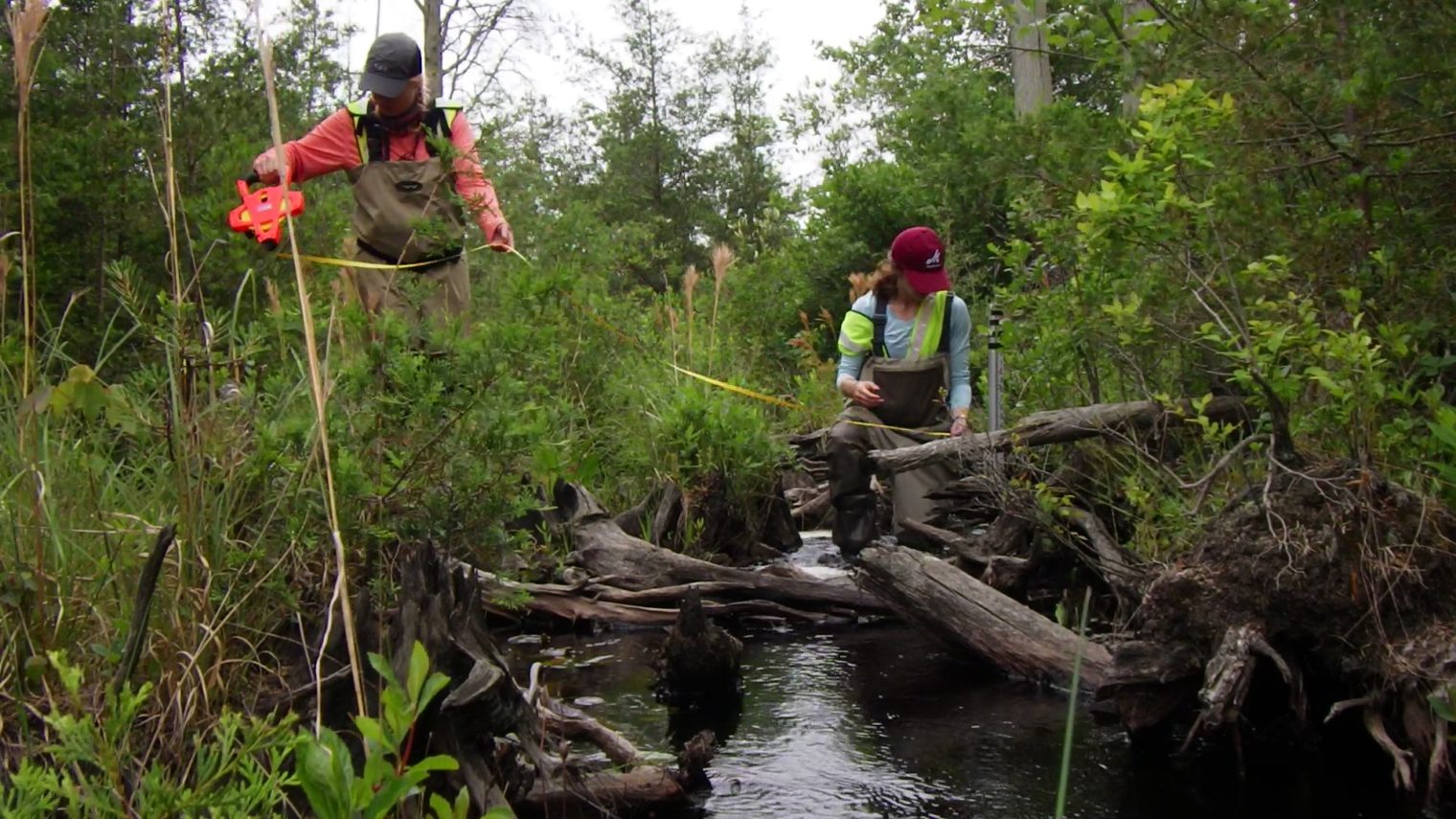
The project team goes on a mission to collect more information. Team members collect and analyze water samples at key points along the rivers, streams, and tributaries. They also conduct visual assessments of stream segments. Walking along the stream, they note the physical characteristics and look for evidence of erosion, poor water quality (like excess algae), stormwater and sanitary sewer infrastructure, and other evidence of non-point source pollution.
The project team takes the information gathered in the field and combines it with other sources of information (previous studies, other water quality sampling, land use maps, etc.) to document the current status of the watershed and expected trends, and to identify areas of concern as they relate to the project goals and objectives. The team now knows what the problems are; the question is how will they be addressed?
Developing the Plan
In the second act, the project team comes up with different ways to tackle the problems identified during the technical analyses. Some of the recommendations may be “structural” (e.g., fix a detention basin, create a treatment wetland, install vegetated swales in a parking lot), while others may be “non-structural” (e.g., purchase land for open space preservation, recommend changes to local ordinances, conduct an education campaign about water use).
The team turns to the Stakeholder Advisory Group for assistance with developing strategies. Together they prioritize the strategies based on local knowledge and their ability to meet the agreed upon objectives. With field data collection, technical analyses, and strategy prioritization complete, the project team pulls it all together to create the Watershed Protection and Restoration Plan – all this only two years since that first Stakeholder Advisory Group Meeting.
Taking Action
In the third act, the team is ready to take on the water quality impairments and put the new plan into action. Up to five conceptual designs will be prepared for each watershed, and working in conjunction with the Stakeholder Advisory Group, one project in each watershed will move forward into planning and construction. Other projects identified in the plan will be implemented once additional funding becomes available. Besides having a suite of strategies for improving water quality at the ready, having an approved plan also makes potential projects eligible for dedicated funding streams that would otherwise be unavailable.
Plans for the Entire Watershed
The Watershed Protection and Restoration Plans being developed by the BBP for Toms River and Cedar Creek/Forked River/Oyster Creek, as well as a separate plan being prepared by a team led by Rutgers University for the Mill Creek and other southern watershed streams, are all funded by the New Jersey Department of Environmental Protection through the 2018 Water Quality Restoration Grant Program. When combined with the Metedeconk River Watershed Protection and Restoration Plan previously prepared by the Brick Township Municipal Utilities Authority with funding from the NJDEP, the entire Barnegat Bay watershed will have approved plans! This is great news for protecting and restoring the bay and its watershed for generations to come.
