The Metedeconk River subwatershed includes the following Ocean County municipalities:
A portion of northern Jackson Township
A portion of Lakewood Township
A portion of Brick Township
A portion of Point Pleasant Borough
A portion of Point Pleasant Beach
Portions of four Monmouth County Municipalities also drain to tributaries of the Metedeconk River: Wall Township, Howell Township, Freehold Township, and Millstone Township. The North Branch of the Metedeconk River borders Howell Township and flows through southern Freehold Township in the southern portion of Monmouth County, which is within the Barnegat Bay watershed.
Watershed Facts
This 90-square-mile subwatershed drains the northern Barnegat Bay watershed. The Metedeconk River flows through nine towns and two counties through over 40 miles of woodlands, freshwater wetlands, forested wetlands, tidal wetlands, and densely developed areas before emptying into the Barnegat Bay. The river and its watershed provide drinking water from ground and surface water sources to about 100,000 homes in Ocean and Monmouth Counties.
The river is divided into two separate entities — the North and South Branches. At Forge Pond, in Brick Township, the two branches converge. Haystack Brook, in southern Howell Township, is the principal tributary to the North Branch of the Metedeconk River. Major tributaries of Haystack Brook are Ground Hog Brook, Muddy Fork Brook, and Dick’s Brook. The South Branch of the Metedeconk River also originates in and flows through southern Freehold Township.
The Metedeconk conjoins with the Point Pleasant Canal to the north, which provides a direct connection to the Manasquan River, which then offers a direct artery to the Atlantic Ocean.
According to 1995 estimates from the New Jersey Department of Environmental Protection, the Metedeconk River subwatershed is 35 percent developed, with a total impervious surface of 17 percent. This number has increased since 1995, resulting in greater losses of forests and wetlands. A study by Rutgers University scientists in 2006 showed that 24 percent of riparian lands in the Metedeconk subwatershed have been altered (urban, barren, or agriculture land uses). Brick Township is the most heavily developed municipality in this subwatershed.
Ecological Features
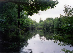
Habitats of the Metedeconk subwatershed are numerous and diverse. They are comprised of forests/woodlands, freshwater, forested wetlands, salt marshes, and tidal wetlands. The Metedeconk River itself is of a floodplain type, due to its connectivity to the Atlantic Ocean. In lieu of this connection to the ocean and the Barnegat Bay, the river experiences tidal fluctuations; the head of tide is just east of the Garden State Parkway. The brackish estuarine water of the Metedeconk River begins around Route 70 in Brick Township, and is freshwater upstream from there along both branches.
Due to the richness and productivity of the waters and surrounding habitats, numerous species of wildlife are attracted to the areas. There are 156 species of special emphasis (52 species of fish and 79 species of birds), found in and around the watershed. Due to the watershed’s location along migratory flyways, you can expect to find various species of endangered and threatened species of waterfowl, shorebirds, birds of prey, and other species of birds. Endangered species like the peregrine falcon, the roseate tern, the northern harrier, and the black skimmer, threatened species like the piping plover, the great blue and little blue herons, the osprey, and the barred owl, all can be found throughout the areas. Other species of animals like the eastern tiger salamander and the northern pine snake can also be found in the watershed. Species of mammals like the whitetail deer, river otters, beavers, and red foxes can all be seen. Many species of finfish can be found and are regularly sought out in the watershed’s waters. Species like bluefish, striped bass, menhaden, spot, weakfish, sandlance, summer and winter flounder all inhabit the waters, depending on the season. Crabbing for the blue claw crab can also be extremely productive and is also a popular activity.
Points of Interest
Edwin B. Forsythe National Wildlife Refuge, Brick Township
Riverwalk Refuge, Brick Township
Windward Beach Park, Brick Township
Traders Cove Park, Brick Township
Brick Reservoir, Brick Township
Butterfly Bogs Wildlife Management Area, Jackson Township
Patriots County Field Sports Complex, Jackson Township
Point Pleasant Canal Access Wildlife Management Area, Point Pleasant Borough
Shenandoah County Sports Complex, Lakewood Township
Lake Carasaljo, Lakewood Township
Lake Shenandoah County Park, Lakewood Township
Ocean County Park, Lakewood Township
Sister Mary Grace Burns Arboretum at Georgian Court University, Lakewood Township
Sign up for email or connect through social media.
We use cookies to ensure that we give you the best experience on our website. If you continue to use this site we will assume that you are happy with it.Ok